Log in
All resources
Create a design
2,977 Free Artworks of City Map
bibliothèque nationale de france
baroque
matthäus merian
bibliothèque municipale de reims, pourtraict de la ville, cité et université de reims
1618 maps of france
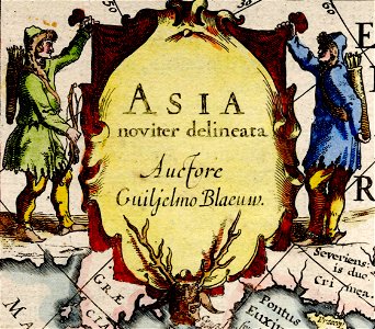
asia noviter delineata
willem blaeu
maps in the library of congress
copper engraving print
hendrik de leth
historical images of tarragona
tarragona in art
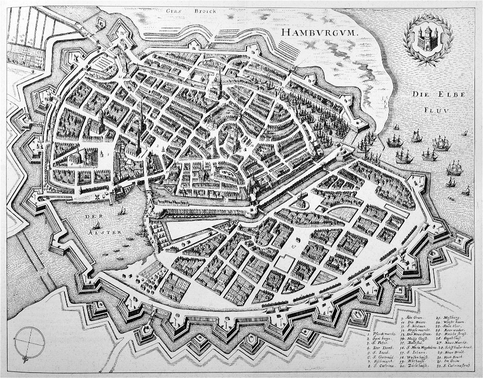
hamburg in topographia saxoniae inferioris (merian)
baroque
maps of cairo by braun & hogenberg
bibliothèque nationale de france
maps of granada by braun & hogenberg
bibliothèque nationale de france
maps from gallica
baroque
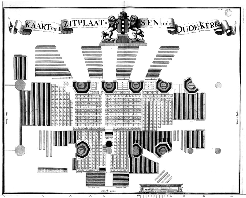
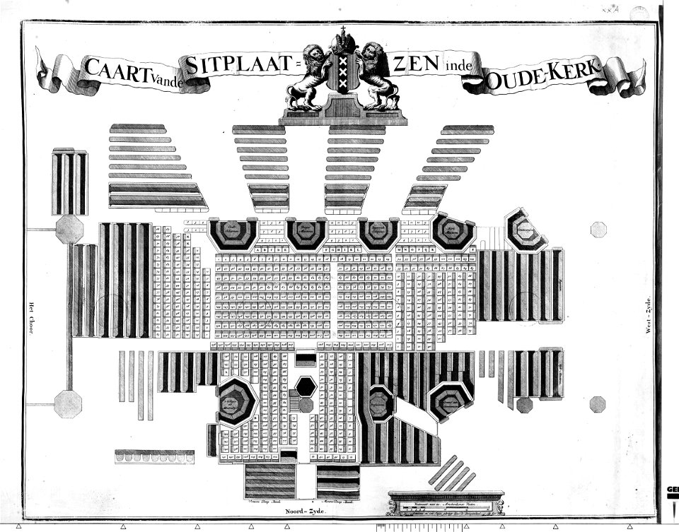
het zegepralent kennemerlant
hendrik de leth
maps of country estates in the netherlands
het zegepralent kennemerlant
maps from university of amsterdam special collections
atlas der neederlanden
liebfrauenkirche halberstadt
halberstadt cathedral
suecia antiqua et hodierna, volume 3
history of visby
media from atlas of mutual heritage on dutch east india company
old maps of cambodia
asia noviter delineata
1617 drawings
asia noviter delineata
1617 drawings
maps of the dutch east india company - sri lanka
1785
ancona (galleria delle carte geografiche)
bibliothèque municipale de reims, pourtraict de la ville, cité et université de reims
1618 maps of france
bibliothèque municipale de reims, pourtraict de la ville, cité et université de reims
1618 maps of france
engravings of topographia helvetiae, rhaetiae et valesiae
baroque
cartouches by willem and johannes blaeu
asia noviter delineata
asia noviter delineata
arab people in art
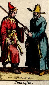
asia noviter delineata
chinese people in art
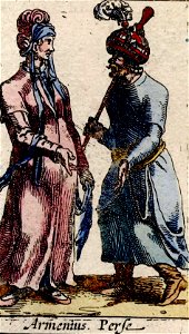
asia noviter delineata
armenians in art
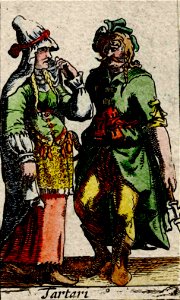
asia noviter delineata
tatar people in art
maps in the library of congress
1849 maps
daniel friedrich sotzmann
1798 in berlin-mitte
prints by wenceslaus hollar in the rijksmuseum amsterdam
maps by wenzel hollar
engravings of topographia helvetiae, rhaetiae et valesiae
baroque
eran laor cartographic collection
claes jansz. visscher (ii)
old maps of the history of france
daniel de la feuille
liber qvartvs contrafactur vnd beschreibung von den vornembsten stten der welt (zzk 0.32)
patrimonium 2 (project)
liber qvartvs contrafactur vnd beschreibung von den vornembsten stten der welt (zzk 0.32)
patrimonium 2 (project)
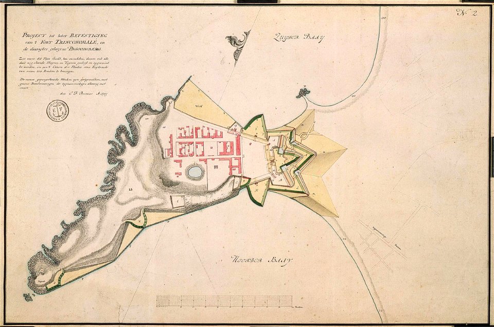
magazine fort, dublin
maps by john rocque
maps from university of amsterdam special collections
atlas der neederlanden
maps from gallica
pierre mortier
engravings by matthäus merian
baroque
1631 stadtbrand von isny im allgäu
baroque
map of amsterdam by julius milheuser after daniël stalpaert, 1662
julius milheuser
civitates orbis terrarum. de praecipuis totius universi urbibus. liber secundus
maps of algiers by braun & hogenberg
maps from the earth and its inhabitants, vol. xvi
19th-century maps of mexico city
maps of the dutch east india company - bengal
maps of the dutch east india company - india
prints by pieter hendricksz. schut in the rijksmuseum amsterdam
maps in the rijksmuseum amsterdam
narrative of a five years' expedition (1806)
romanticism,fairy painting
maps of brussels by braun & hogenberg
bibliothèque nationale de france
maps of eschwege by braun & hogenberg
maps of fritzlar by braun & hogenberg
maps of alexandria by braun & hogenberg
bibliothèque nationale de france
maps of santander by braun & hogenberg
bibliothèque nationale de france
maps of lyon by braun & hogenberg
bibliothèque nationale de france
maps of freiberg by braun & hogenberg
bibliothèque nationale de france
maps of leeuwarden by braun & hogenberg
maps of franeker by braun & hogenberg
maps of deventer by braun & hogenberg
bibliothèque nationale de france
maps of florence by braun & hogenberg
maps of genoa by braun & hogenberg
maps of setenil de las bodegas by braun & hogenberg
maps of lebrija by braun & hogenberg
west-indische compagnie
1671
historic views of cities in germany by matthäus merian
baroque
drawings in hcl (maastricht)
maastricht in the 1820s
pompeiana - the topography, edifices, and ornaments of pompeii (1817)
maps of pompeii
bibliothèque municipale de reims, pourtraict de la ville, cité et université de reims
1618 maps of france
johann friedrich walther
1738 in berlin-mitte
maps in the library of congress
1752 maps of north america
english-language maps
maps by john cary
1794 maps of the holy roman empire
english-language maps of europe
maps in the stadsarchief amsterdam
hendrik de leth
bibliothèque municipale de reims, pourtraict de la ville, cité et université de reims
1618 maps of france
bibliothèque municipale de reims, pourtraict de la ville, cité et université de reims
1618 maps of france
bibliothèque municipale de reims, pourtraict de la ville, cité et université de reims
1618 maps of france
bibliothèque municipale de reims, pourtraict de la ville, cité et université de reims
1618 maps of france
old maps of the tribes of israel
old maps of ancient israel
atlas des anciens plans de paris by imprimerie nationale, 1880 from bhvp
baroque
maps of lisbon by braun & hogenberg (1572)
maps of cascais by braun & hogenberg
old maps of székesfehérvár
1601 in hungary
birckenstein handgriffe (image set)
historical images of székesfehérvár
collection cartographic documents from het utrechts archief
laurens praalder
malta (galleria delle carte geografiche)
old maps of malta
maps of the hague by braun & hogenberg
the hague in the 1700s
romanticism,neoclassicism
jacques nompar de caumont
alexander jackson davis
william d. smith
historical images of tortosa
history of tortosa
währinger straße, vienna
conrad grefe
maps of frankfurt (oder) by braun & hogenberg
frankfurt (oder)
old maps of bergamo
alvise cima
bibliothèque municipale de reims, pourtraict de la ville, cité et université de reims
1618 maps of france
hamburg in topographia saxoniae inferioris (merian)
baroque
demolished train stations in frankfurt am main
demolished buildings in frankfurt-innenstadt
engravings of topographia helvetiae, rhaetiae et valesiae
1638 in switzerland
new york state supreme court 60 centre street
bromley maps of manhattan published in 1911
johann friedrich walther
1737 in berlin-mitte
eran laor cartographic collection
claes jansz. visscher (ii)
urban landscapes in the archives municipales (lyon)
lyon in the 16th century
maps in the library of congress
1763 maps of north america
maps of strasbourg in the 17th century
gerard jollain
1780s maps of the americas
1786 maps
1769 in berlin-mitte
1760s maps of berlin
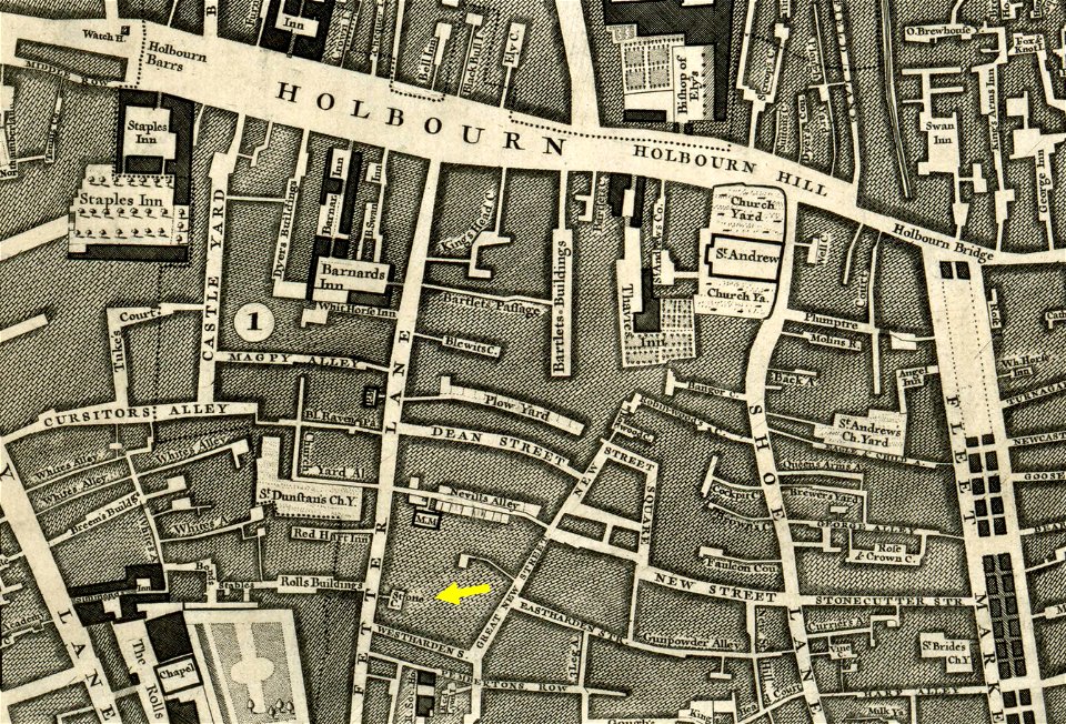
john rocque 1746 crops from library of congress
john rocque
john rocque 1746 crops from library of congress
maps in the library of congress
le antichità romane (piranesi)
neoclassicism
maps by willem and johannes blaeu
siege of 's-hertogenbosch
a school geography (1898) by bird
1898 maps of new york city
construction drawings in the stadsarchief amsterdam
daniel stoopendaal
construction drawings in the stadsarchief amsterdam
daniel stoopendaal
maps of antwerp by braun & hogenberg
bibliothèque nationale de france
1401 - 1500 of 2,977
Next page
/ 30